K captured some grasshoppers and K and J observed them for about an hour this afternoon. They read about the various sources of food for grasshoppers and also what part they play in the food chain for other animals.
Today, we read Oil Spill by Melvin Berger, A stage 2 science book that talked about the Exxon Valdez oil spill, the effects of the spill on wildlife, and the various causes and methods of containment for an oil spill. After reading the book, we reviewed a map of the Gulf of Mexico and discussed the oil rig sinking and oil leak off of the Mississippi Del;ta. We talked about the spread of the oils pill and how currents, which we learned about in Paddle to the Sea, will draw the spill around Florida to its East Coast. We then talked about ways to rescue wildlife and performed a science experiment to see how dish-washing detergent repels oil. We also discussed the different methods used to try and cap or stop the continuing stream of oil under the ocean.
Showing posts with label geography. Show all posts
Showing posts with label geography. Show all posts
Wednesday, May 5, 2010
Saturday, August 8, 2009
Yellowstone and vulcanism
Discussed geology with the kids in and around Yellowstone park. What causes geysers and hot springs, and how a magma chambers can heat the liquids and earth above it. Discussed the possibilities of an eruption and how remnants of earlier eruptions on volcanoes in western United Sates can be found in several western states.

Thursday, July 16, 2009
Countries and Capitals
Reviewed countries and capitals. Parker can now readily identify the capitals of the following countries from a list (and a majority from memorization):
- Egypt
- Russia
- Mexico
- United States
- Great Britain
- France
- Greece
- China
Friday, May 29, 2009

Tuesday, March 31, 2009


Wednesday, December 31, 2008
Gibraltar and Spain
P viewed a map of Spain and Morocco. He looked at photos of Gibraltar and looked at how the forts on the rock controlled shipping in and out of the Mediterranean.
Sunday, December 28, 2008
Largest Countries
P Identified Russia and Canada as the two largest countries in the world. He also identified Japan Spain, and Morocco on the map.
Sunday, December 21, 2008
Geography Identification
P identified the United States, Canada, Mexico, Great Britain, Australia, New Zealand, Greenland, Russia, China, and Egypt on a world map. He was also able to name and identify the seven continents and the four major oceans. Finally he named all the planets in order of distance from the sun.
Tuesday, August 12, 2008
The National Geographic Atlas

P has been reading the "Habitable Earth" chapter of the National Geographic atlas, using the map legends to determine where on the globe certain things are, like mild summers/cool winters (finding where in America has the same temperatures as western Germany), and determining what the temperature is in Florida.
Yesterday, he went through to locate where the major religions in the world are located. He also looked at the maps showing how plate tectonics have moved the continents over the past 600 million years. Each of these maps has a paragraph description that he's been reading to us, which, when ran through a SMOG readability calculator is apparently college-level reading!
Like his father, P just loves looking at maps and seeing how things are different in different places.
Saturday, August 9, 2008
Tectonic Plates and World War II
We looked over the atlas with Parker and described the events of Word War II in general terms, and talked about all of the places where there were battles. We then talked about tectonic plates and shifting, looking at maps of how the Earth looked up to 250 million years ago, and the projected maps of what earth will look like 250 million years hence. P used his grits this morning to make 'continent plates', which he pushed together to make mountains.
Monday, July 14, 2008
July 14th
P used his National Geographic flash cards to answer true and false questions. He divided the cards between mammals and others; carnivores and herbivores; warm and cold blooded; by geographical region; water versus land; and by fur, feather, or other.
K practiced her writing today, doing free form copying of written words. Her letters are far better formed than P and easily read.
P found Madagascar on the map and identified it was larger than New Zealand.
K practiced her writing today, doing free form copying of written words. Her letters are far better formed than P and easily read.
P found Madagascar on the map and identified it was larger than New Zealand.
Saturday, July 12, 2008
July 12th
P and Jeff finished reading the biography of John F. Kennedy. P then asked to look at the Kennedy home in Hyannis Port, the White House, and Dallas.
P and K practiced handwriting by tracing over their names.
P and K practiced handwriting by tracing over their names.
Thursday, July 3, 2008
July 3rd
Looked at Hawaii, salt flats of Bolivia and Chile, discussed volcanoes, heat, and the way lava flows and plants reclaim territory.
P displayed understanding of sun's role in illuminating atmosphere.
P displayed understanding of sun's role in illuminating atmosphere.
Sunday, June 29, 2008
June 29, 2008

Today P and I looked at the weather in Florida and discussed how to read a radar map and tell where it is raining the hardest. We then looked at an equivalent map that showed ice thickness and coverage at the North Pole. We then looked at the South Pole and the various research stations on the continent, and watched a time lapse video of the seasons in Antarctica. We discussed the differences in temperatures, the aurora australis and what causes it, and what an ice breaker does.
In the afternoon, we went to wee WALL-e. Afterwards we discussed the idea of living on a spaceship and what things you could do or can't do in a sealed environment.
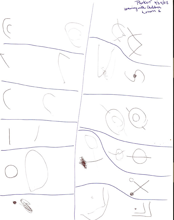
In the early evening, P, K and I did a preliminary lesson from the Drawing With Children book, doing some repetition of basic shapes. Later, we did the volcano science experiment in the tub again.
Resources:
Google Earth
Panoramino
The Cryosphere Today
Drawing With Children
Wall-E
Saturday, May 24, 2008
Glaciers, Ice Age, Tools
Read E.H. Gombrich's A Little History of the World, Chapter 2: "The Greatest Inventors of All Time"
Discussed Ice Age using a glacial extent map and talked about glacier safety, using lines, picks, etc. Learned word "crevasse" and meaning. Briefly talked about copper and bronze age tools.
Discussed Ice Age using a glacial extent map and talked about glacier safety, using lines, picks, etc. Learned word "crevasse" and meaning. Briefly talked about copper and bronze age tools.
Monday, May 5, 2008
Global Domination Risk
Today, P and I spent several pockets of the day playing Risk, for 2 players. We took turns placing our armies and later applying new armies and attacking. Adding is required a lot (P referred to it as a counting game!), and then we consulted a chart we created to determine what the total number of added countries we each controlled was when divided by 3 and rounded up (such that 1, 2, 3 = 1; 4, 5, 6 = 2; 7, 8, 9 = 3; etc.).
Strategy is the point of the game, and that was used to determine whether or not to attack an opponent. Comparisons of army totals (for example, 5 armies on Congo is greater than 3 armies on North Africa, and therefore more likely to succeed) and learning the Roman numerals (I, III, V, X) for the pieces representing the army numbers also was used. Figuring out how to win an entire continent to get the bonus number of armies as well as matching up cards to get more armies was another aspect of the game.
Although we did modify a few of the rules (like the increasing value of the cards), P was very amenable to the rule modification from the sample run with Jeff the day before. P quickly controlled Australia, and my attempts to maintain South America were repeatedly assaulted by P taking over North Africa and attacking from there. I had him read/sound-out/say all the country names, which is hard when Irkutsk is one of them! Near the end, I briefly held North America before he invaded from Asia, and he had Europe for a while before I took out Western Europe and swept through from there. We ended up stopping the game because it was very late, and he definitely was well within a position to completely win.
Strategy is the point of the game, and that was used to determine whether or not to attack an opponent. Comparisons of army totals (for example, 5 armies on Congo is greater than 3 armies on North Africa, and therefore more likely to succeed) and learning the Roman numerals (I, III, V, X) for the pieces representing the army numbers also was used. Figuring out how to win an entire continent to get the bonus number of armies as well as matching up cards to get more armies was another aspect of the game.
Although we did modify a few of the rules (like the increasing value of the cards), P was very amenable to the rule modification from the sample run with Jeff the day before. P quickly controlled Australia, and my attempts to maintain South America were repeatedly assaulted by P taking over North Africa and attacking from there. I had him read/sound-out/say all the country names, which is hard when Irkutsk is one of them! Near the end, I briefly held North America before he invaded from Asia, and he had Europe for a while before I took out Western Europe and swept through from there. We ended up stopping the game because it was very late, and he definitely was well within a position to completely win.
Saturday, March 29, 2008


Sunday, March 16, 2008
Flying Cloud
Today, P learned about the Flying Cloud (which I mistakenly thought was the name of our model ship, which is in actuality a model of the Gorch Fock; my parents' model was the Flying Cloud). P remembered several hours later that the Flying Cloud sailed from New York to San Francicso around South America (Cape Horn) in a record 89 days. He used a world map to trace the pathway from New York to San Francisco. He then, looking at the map, suggested that another path might have been north around Canada through the Queen Elizabeth islands; Kristin suggested to him that it would be very cold with ice that way.
Thursday, August 16, 2007
Creating a Village

The general dynamics of a village were illustrated in the development of the "town village". Starting with a village square and creating pathways out, P made sure to include strategic buildings including a stable and blacksmith, marketplace, and armory. Defending the town was quite important, too.
Subscribe to:
Posts (Atom)


